The evolving China-Pakistan space cooperation
S&T – SPACE
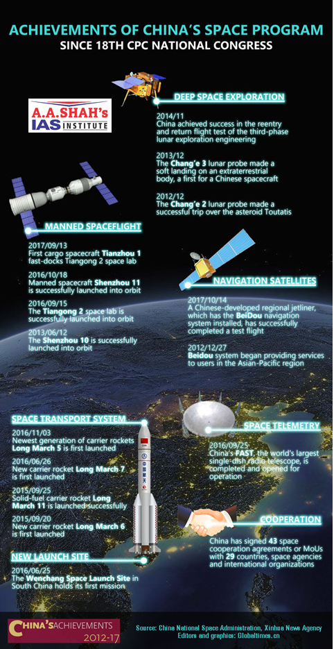
- The Chinese space programme has undertaken major strides since it built and launched its first satellite in 1970.
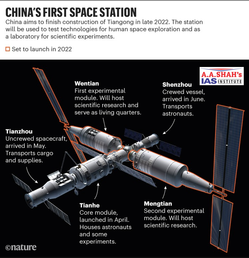
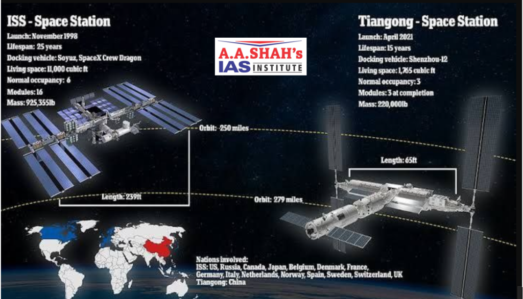
- In last half a century Beijing has conducted satellite launches, built its own navigation system, carried out successful spacewalks, and built and operated its own space station.
- China is also in the process of undertaking a manned moon mission by 2030.
Chinese Space Co-operation
- China has also consistently promoted its space technologies and pushed for cooperation under Belt and Road Initiative (BRI).
- This entails “a service network weaved by satellites and ground stations among the BRI partner countries has promoted the space industry to better benefit the local people”.
- China has also used its launching platform, the Long March, to promote its soft power by launching satellite for a number of other countries.
China-Pakistan Space Co-operation
- China Pakistan space cooperation began in 1990 with China launching Pakistan’s Badr-I satellite.
- Today, China has built and launched satellites for Pakistan and in 2026 announced that it will send one Pakistani astronaut to the Tiangong space station.
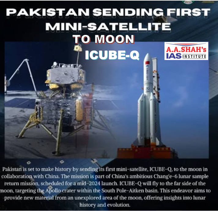
- China had also launched the ICUBE-Q in 2024 on Chang’e 6 orbiter. This was developed in a collaboration between the Pakistan’s Institute of Space Technology (IST) and Shanghai Jiao Tong University (SJTU).
- The ICUBE-Q, a lunar CubeSat weighing about 7kg was to explore the far side of the moon.
- It was successful in capturing images of the moon and the sun and transmitting them back to Earth.
- The first Pakistani communication satellite PAKSAT–IR was launched in 2011.
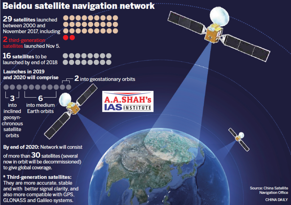
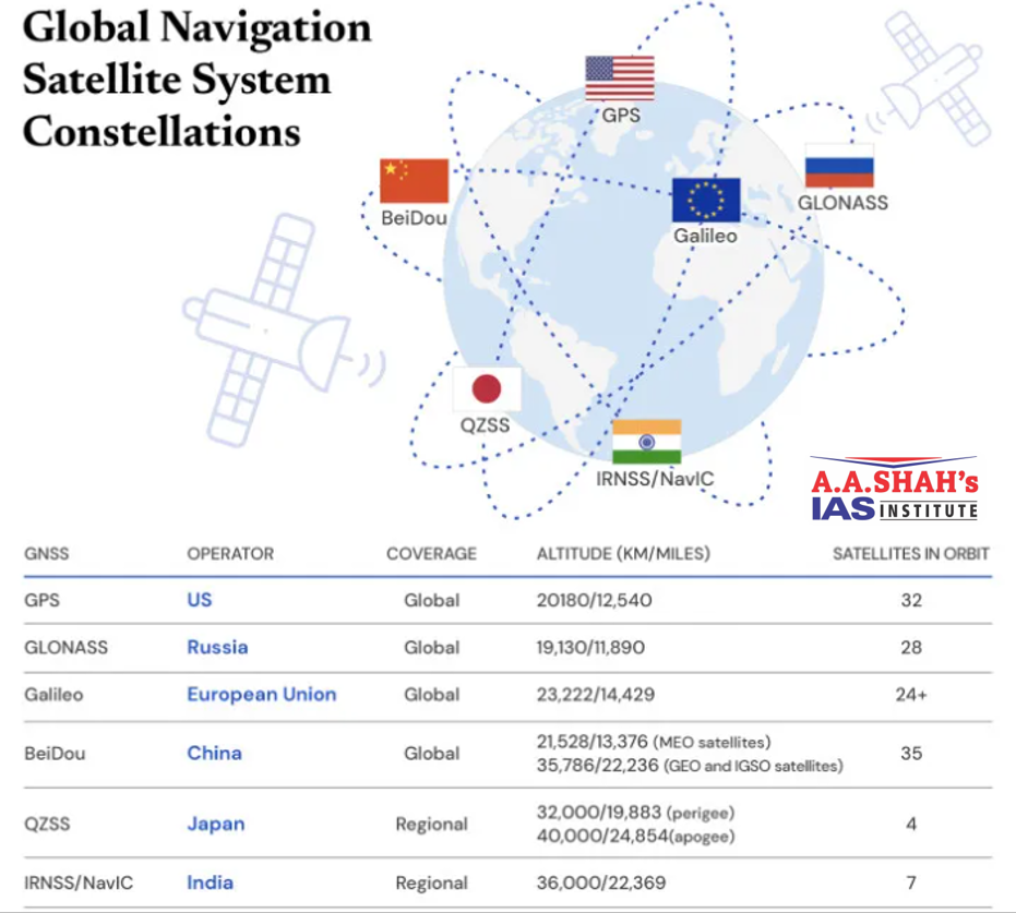
BeiDou Navigation Satellite System (BDS)
- BeiDou Navigation Satellite System (BDS) is China’s indigenous navigation system.
- It is also seen as the plausible alternative to the United States, Global Positioning System (GPS).
- The BeiDou system is considered to be very precise with providing information with 2 centimetres precision and this can be improved to 5 millimetres after image processing.
- This can be very helpful in disaster relief, urban planning, traffic guidance as well as environmental management.
- In 2014 Pakistan became the first foreign country to use the BeiDou navigation system.
- Under the China-Pakistan defence cooperation, the Pakistani military is all equipped to use the BeiDou system.
- In 2020 Chinese Satellite Navigation Office (CSNO) had announced that they will be establishing a Continuously Operating Radar Station (CORS) network in Pakistan which will be BeiDou enabled.
- The developments highlight that the ties between China and Pakistan has moved to the space arena as well, giving Islamabad a strategic advantage.